
 EN
EN
Enables Faster Target Detection and Situational Awareness in Emergencies, Night Operations, and Complex Environments.
The Clock That Doesn't Stop
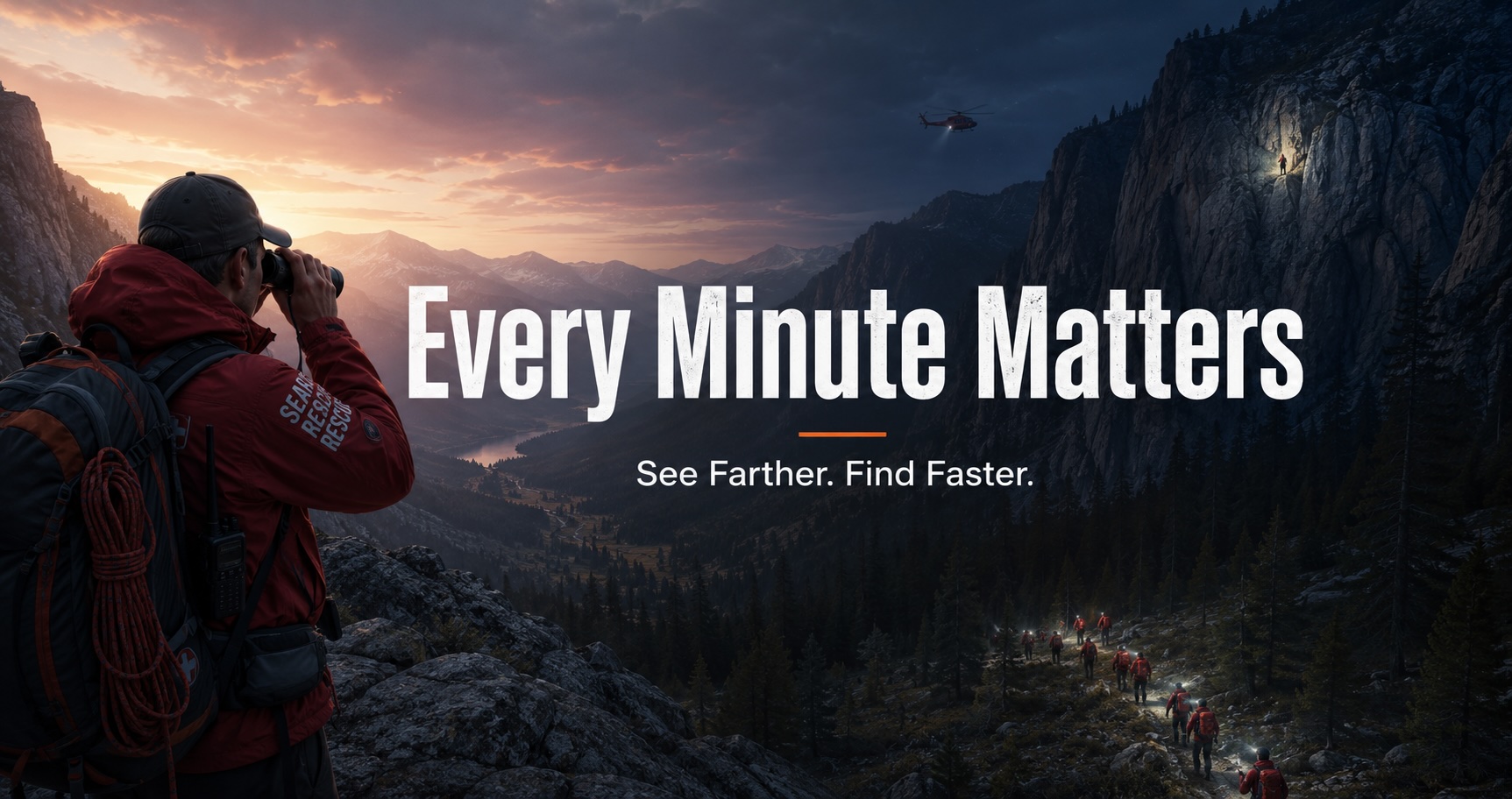
Search and rescue operations are defined by a single variable that everything else serves: time.
The survival probability curve for a missing person in wilderness terrain is not linear — it drops sharply within the first 24 hours, and more sharply still across the first 72. Hypothermia, dehydration, injury complications, and the compounding effects of exposure mean that the gap between a 6-hour response and a 24-hour response is not a matter of degree. In mountain terrain in winter, or desert terrain in summer, it is frequently the difference between a rescue and a recovery.
Every decision a search and rescue team makes — where to send which team, how to allocate helicopter flight time, which terrain features to prioritize, when to expand the search perimeter — is a bet placed against that clock. Better information produces better bets. Better bets produce faster finds. Faster finds save lives.
The observation technology available to a search team in the field directly determines the quality of information those bets are placed on. A team that can visually cover more terrain per hour, identify subjects at greater distance, communicate precise location data to incident command without radio relay errors, and maintain operational awareness in low-light and complex terrain conditions will find people faster than a team without those capabilities.
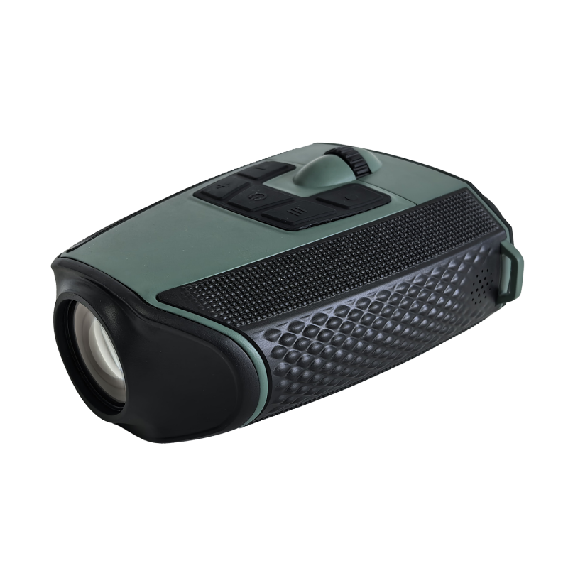
This is the operational context the S7 is built for — not as a consumer outdoor product that happens to be useful in emergencies, but as a field observation platform whose specific technical capabilities address the specific information problems that search and rescue operations encounter.
Where Conventional Search Equipment Falls Short
Search and rescue teams operate with equipment that has evolved incrementally from civilian outdoor gear and military surplus — binoculars, radios, GPS handhelds, and in well-resourced teams, thermal imaging. Each tool was designed for a context adjacent to search and rescue rather than for it directly, and the limitations that result are operational constraints that teams work around rather than solve.
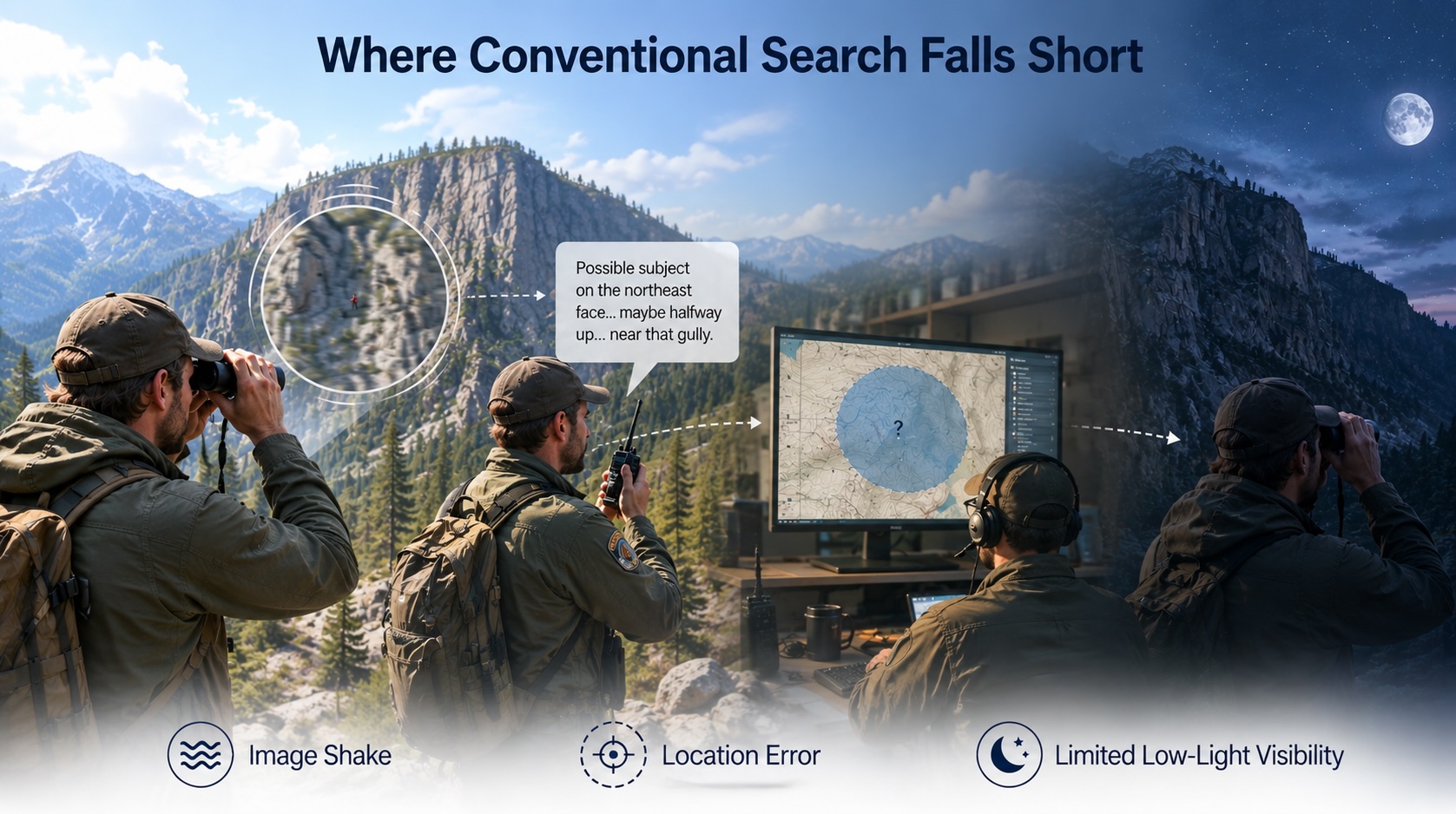
Conventional binoculars at high magnification are unusable in the field without a tripod. A standard 10×42 binocular is the practical ceiling for handheld use in the field — beyond that, image shake from the observer's movement makes sustained observation impossible. But the terrain features where missing persons are most commonly located — cliff faces, dense forest canopy, rocky outcrops, steep couloirs — are precisely the features that benefit most from higher magnification. A team member who needs to scan a cliff face at 300 meters for a person in a blue jacket against grey rock needs more than 10×, and the tripod required to use more than 10× adds equipment weight and setup time that field operations cannot absorb.
Location communication from field teams to incident command is a consistent source of error. A team member who spots a subject at distance communicates the location verbally — a bearing and distance estimate, a terrain description, a grid reference read from a GPS device that may not be precisely calibrated to the mapping system command is using. Each translation step in that chain introduces error. The subject's actual location and the location plotted at command may differ by hundreds of meters — enough to send a response team to the wrong approach route.
Night and low-light search capability is limited without dedicated equipment. The hours between dusk and dawn are both the highest-risk period for missing persons — temperature drops, visibility drops, the psychological effects of darkness compound — and the period during which visual search capability is most degraded. Thermal imaging addresses this but at a cost and weight that limits availability to well-resourced teams and helicopter operations. Standard night vision amplification equipment is military-derived, expensive, and not optimized for the search task.
Documentation of field observations is inconsistent. A team member who sights a potential subject at distance — a flash of color, movement in the canopy, a figure on a ridge — needs to communicate that observation to command with enough precision that it can be acted on even if the observer loses the visual. Verbal description and manual notation are the current standard. Both are error-prone under the cognitive load of an active search operation.
What the S7 Changes for Search Operations
The S7's technical specifications map directly onto the operational limitations that search and rescue teams encounter — not as a coincidental overlap, but as capabilities that address specific field information problems.
25× stabilized optics: the magnification that field search actually needs.
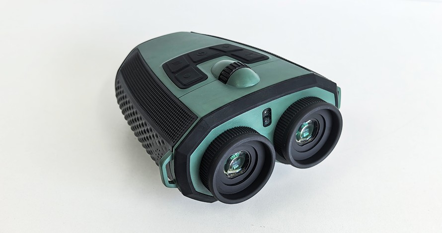
The S7's Electronic Image Stabilization delivers usable, sustained observation at 25× optical magnification without a tripod. For search operations, this changes the effective visual coverage radius of a team member on an elevated observation point.
At 10× — the practical ceiling for conventional handheld binoculars — a person in neutral-colored clothing against varied terrain at 200 meters is difficult to distinguish from background features. At 25× with stabilization, the same subject at 400 meters is observable with enough detail to assess clothing color, posture, movement, and whether the subject is responsive. The linear increase in magnification translates to a geometric increase in the terrain area that can be effectively searched from a single observation position.
For search operations where helicopter time is expensive and ground team deployment is logistically constrained, the ability to visually clear a terrain feature from a distance — confirming the absence of a subject before committing to a ground approach — has direct operational value. A team that can clear a canyon wall or a ridgeline from a distance eliminates it from the search grid without consuming the time and physical resources of a ground approach.
The 40.8mm objective lens and dual 0.49" AMOLED displays at 1920×1080 render the stabilized image with the clarity required to distinguish a person from terrain features, assess their condition from a distance, and identify distinguishing characteristics — clothing color, pack color, whether they are moving or stationary — that inform response prioritization.
GPS and gyroscope positioning: eliminating location communication error.
When an S7 operator identifies a potential subject, the device's integrated GPS records the observer's position and the gyroscope-based compass records the bearing toward the subject. Combined, these two data points define a line of bearing from a known location — sufficient for incident command to plot the direction on a mapping system and identify the terrain feature at the intersection of that bearing with known topography.
This replaces the verbal bearing-and-distance estimation that currently introduces location error into field-to-command communication. The GPS coordinate and gyroscope bearing are objective measurements — not estimates — and they transfer to command via the S7 app without transcription error.
For multi-team searches where command is integrating observations from several field teams simultaneously, the ability to receive precise geotagged observation data from each team and plot it on a single operational map changes the quality of the search picture available at command. Overlapping lines of bearing from two team positions can triangulate a subject location with a precision that verbal reporting cannot approach.
AI recognition: reducing false positives in complex terrain.
Search operations generate a high volume of potential sightings — terrain features that resemble human figures, wildlife movement mistaken for subject movement, debris that resembles clothing or equipment. Each potential sighting requires evaluation: is this the subject, or is this background? Every false positive that sends a response team to an empty location costs time that the clock cannot return.
The S7's AI recognition system — 10,000+ bird species and 30 mammal categories at 95% accuracy — is designed for wildlife identification, but the underlying computer vision capability that distinguishes a bird from background foliage at distance is the same capability that helps a search team observer distinguish a stationary human figure from terrain features that approximate human form.
This is not a dedicated search-and-rescue AI system. It is an observation tool that reduces the cognitive load of sustained visual search by providing a second analytical layer on what the observer's eye is seeing — confirming identifications that matter and flagging observations that warrant closer examination.
2.7K video documentation with live streaming: command visibility into field observation.
When an S7 operator is observing a potential subject location, the 2688×1520 video capture creates a documentary record of what the observer is seeing — timestamped, GPS-tagged, available for review regardless of what the observer communicates verbally in the moment.
More operationally significant is the live streaming capability. An S7 in the field, streaming to the incident command post via the companion app, gives command staff direct visual access to what a field team is observing in real time — without requiring the observer to describe it verbally, without the information loss of verbal relay, and without the time delay of after-action reporting.
For command staff making real-time decisions about resource deployment — which team to send where, whether to call in helicopter support, whether a sighting warrants immediate response or continued observation — direct visual access to field team observation is qualitatively different from receiving a verbal description of it. It eliminates the interpretation layer between field observation and command decision.
Night and low-light operation: the hours the clock runs fastest.
The S7 supports both Day and Night scene modes, with the 2688×1520 sensor and 40.8mm objective lens providing light-gathering capability that extends usable observation into low-light conditions beyond what standard binoculars can sustain.
For search operations that extend into or begin during the night hours — the highest-risk period for missing persons in temperature-sensitive environments — the S7's night mode extends the operational effectiveness of ground team visual search beyond the point where conventional optics become unusable. This does not replace thermal imaging for the applications where thermal is required — detecting body heat signature against cool background is a thermal capability that optical systems cannot replicate — but it extends visual search capability into the low-light range between full darkness (thermal's domain) and full daylight (conventional optics' domain).
The -25°C to 55°C operating temperature range covers the conditions under which mountain, alpine, and winter search operations are conducted. IP66 weatherproofing covers rain, snow, and the condensation that results from moving between cold exterior and warmer interior environments that field teams encounter on extended operations.
6-hour battery life: full operational shift coverage.
Search operations run in shifts. A standard field team shift in most SAR organizations is 6–8 hours. The S7's 6-hour battery life covers a full operational shift on a single charge — relevant in backcountry contexts where recharging in the field requires carried battery packs, and where a device that dies mid-shift is an operational liability rather than an asset.
The USB Type-C interface is compatible with the power banks that field teams already carry for radio and GPS device charging — no proprietary charging infrastructure required.
Trail Cameras as Search Infrastructure
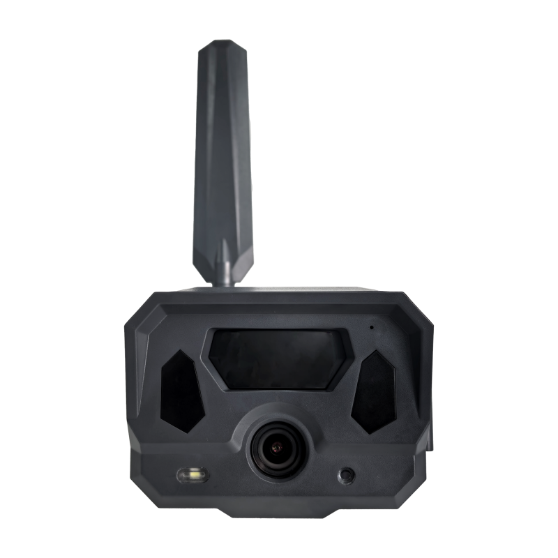
While the S7 is the primary platform for active search operations, trail cameras serve a specific and underutilized function in the search and rescue context: as deployed observation infrastructure along travel corridors where missing persons are likely to pass.
Missing persons in wilderness environments — particularly those who are disoriented, injured, or suffering from hypothermia — tend to follow paths of least resistance: trails, stream beds, valley floors, road margins. Deploying cellular trail cameras at key corridor intersections ahead of a search operation establishes a passive detection network that covers those routes continuously, without requiring team members to physically monitor each location.
A person moving through a monitored corridor at 3am — hours before the ground team reaches that section of the search area — triggers the camera, transmits the image via cellular, and generates an alert at command. The timestamp and GPS location on the transmitted image immediately narrows the search area to the terrain accessible from that point in the elapsed time since the trigger event.
This application requires the cellular transmission capability that distinguishes Willfine's platform from SD-card trail cameras — the value is in the real-time alert, not in the image record discovered after the search is complete.
The 5.8CS's compact 260g body and 0.4-second trigger cover the deployment requirements: light enough to carry in operational packs, fast enough to capture a moving subject, cellular-connected for real-time alert transmission, and app-managed for GPS location tracking across a distributed deployment.
For extended operations where cameras are deployed for multiple days across a large search area, the 5.8T-CG's approximately 10-month battery standby removes battery management from the operational burden — deployed cameras remain active for the duration of any realistic search operation without requiring battery replacement in the field.
What Institutional Buyers Evaluate
Search and rescue equipment procurement — whether by government SAR agencies, volunteer SAR organizations, mountain rescue teams, or emergency management authorities — involves evaluation criteria that differ from consumer outdoor gear purchasing in several important respects.
Operational reliability under adverse conditions. Equipment that performs in controlled testing but fails in field conditions — cold temperatures, rain exposure, physical impact from field use — is an operational liability. IP66 weatherproofing, -25°C to 55°C operating range, and field-tested durability across Willfine's lineup address the environmental standards that SAR equipment must meet.
Integration with existing operational infrastructure. The S7's GPS coordinate output, gyroscope bearing data, and live streaming capability need to integrate with the mapping systems, communication infrastructure, and command post workflows that SAR organizations already use. The S7 app's data output and the Trailcam Ace platform's GPS mapping are designed for interoperability with standard operational tools rather than requiring proprietary systems adoption.
Training burden. Volunteer SAR organizations — which constitute the majority of wilderness search capacity in North America and Europe — cannot absorb complex new equipment training alongside their existing operational preparation. The S7's core observation function requires no training beyond conventional binocular use. The additional capabilities — AI identification, GPS tagging, live streaming — are accessible through the companion app interface that mirrors the smartphone interaction model that team members already use.
Documentation standards. Search operations generate legal documentation requirements — incident reports, evidence chains, operational records — that equipment used in the field must support. GPS-tagged, timestamped images and video from the S7, stored in cloud infrastructure via the companion app, provide documentation that meets these requirements without requiring separate documentation procedures.
OEM and institutional supply considerations. For OEM buyers supplying SAR equipment to government agencies, emergency management authorities, or large volunteer organizations, the relevant platform capabilities include multi-unit pricing, white-label deployment for institutional branding, CE and FCC certification for regulatory compliance, and technical support infrastructure adequate for institutional procurement standards.
Product Specification Summary
S7 Smart Binoculars — Search & Rescue Configuration
| Parameter | Specification | SAR Relevance |
| Magnification | Optical 1–25× | Extended visual search range without tripod |
| Image stabilization | EIS | Sustained 25× observation from field positions |
| Video resolution | 2688×1520 (2.7K) · 60Hz | Documentation quality for operational records |
| Display | Dual 0.49" AMOLED · 1920×1080 | Clear subject assessment at distance |
| Autofocus | ✓ | Rapid focus acquisition on moving subjects |
| GPS | ✓ | Precise observer location for bearing calculation |
| Compass / Gyroscope | ✓ / ✓ | Bearing to subject without magnetic interference |
| Live streaming | ✓ | Command visibility into field observation |
| AI recognition | 10,000+ bird · 30 mammal · 95% accuracy | Observation support in complex terrain |
| Night mode | ✓ | Extended low-light operational capability |
| Memory | 32GB / 64GB | Extended operation without file management |
| Battery | 6 hours | Full operational shift coverage |
| Waterproof | IP66 | Rain, snow, condensation exposure |
| Operating temp | -25°C to 55°C | Alpine and winter operation |
| LRF | Customizable | Distance measurement for subject location |
| Interface | USB Type-C | Compatible with standard field power banks |
| Weight | 980g | Expedition-grade field equipment |
Trail Cameras — SAR Corridor Monitoring
| 5.8CS | 5.8T-CG | |
| SAR use | Active search corridor monitoring | Extended multi-day deployment |
| Connectivity | Cat.4 + Trailcam Ace | Cat1 bis + SMTP/FTP |
| Alert | Push notification via app | SMTP/FTP to command email |
| Trigger | 0.4s | 0.4–0.5s |
| Night vision | 60pc 940nm / 20m | 60pc IR / 20m |
| Battery | 8 AA · 6 mo | 8 AA · ~10 mo |
| GPS tagging | ✓ | ✓ |
| OTA | ✓ | — |
| Waterproof | IP66 | IP66 |
| Operating temp | -20°C to 55°C | -20°C to 55°C |
| Body | 128×96×76mm · 260g | 128×96×76mm · 260g |
Who Builds on This Platform
Willfine's search and rescue OEM program serves institutional buyers and equipment suppliers operating at the intersection of professional field optics, emergency management, and outdoor safety equipment.
The program is most relevant for emergency management equipment suppliers building SAR-specific optical and monitoring product lines for government agency procurement; outdoor safety brands extending into professional and semi-professional SAR equipment for volunteer organization supply; military and law enforcement equipment distributors whose customer base includes SAR-adjacent applications — border patrol, park ranger operations, coastal surveillance — that share the same observation and awareness requirements; regional distributors in mountain rescue and wilderness SAR markets across Europe and North America where organizational procurement cycles create defined supply opportunities; and institutional buyers — national park services, coast guard auxiliary organizations, mountain rescue associations — evaluating direct procurement of observation equipment for team deployment.
Request the Search & Rescue Platform Brief
OEM evaluation and institutional procurement inquiries begin with a technical consultation, S7 sample unit with full operational demonstration, and trail camera deployment assessment for corridor monitoring applications. White-label deployment terms and institutional pricing are provided under NDA for qualified buyers.
Contact Willfine to request the search and rescue platform brief.